Maps
Trail Maps
Find trail info and trail specific maps by clicking on a trail name or a red map pin below.
Walking Guides
Walking guides for specific communities, including Anderson, Cottonwood, Redding, and Shasta Lake
Burney/Pit River Walks Guide – Feedback Needed
Do you live in the Burney/Pit River region? We need your help to create a community walks guide for your area. You can help by telling us where you like to walk, hike, and stroll.
Give us feedback by completing the Burney/Pit River community walks survey where you can draw or describe local places to walk. The Burney/Pit River walks survey can be found at the Burney Library and the Intermountain Community Center starting next week. You can, also, download the survey in English and Spanish using the links below.
Burney-Pit River Walks Guide_feedback form
Guía de rutas para caminar de Burney_Final
Completed survey forms can be returned to boxes at the Burney Library and the Intermountain Community Center, or you take a picture and email to admin@healthyshasta.org.
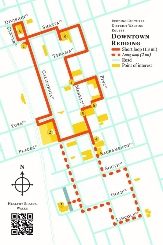
Redding Cultural District Walking Routes
Downtown Redding
Bike Redding Transportation Guide (pdf)
Map of on-street bikeways and trails in Redding