Trail Maps
Find trail info and trail specific maps by clicking on a trail name or a red map pin below.
Community Walk Guides
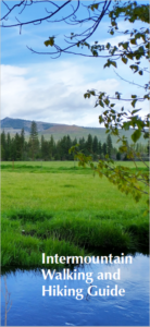
Intermountain Walking and Hiking Guide
The Intermountain Walking and Hiking Guide booklet, featuring local walking routes and trails recommended by the community and photo contest winners’ pictures, will be available at the Burney Library, the Fall River Valley Library, the Intermountain Community Center, and other local spots.
Thank you to our photo contest participants for sharing your beautiful photos! Congratulations to Jen Luck who took first place, and whose work will be featured on the cover of the Intermountain Walking and Hiking Guide. Photos that received honorable mention will be found throughout the guide. Honorable mentions were submitted by: Becky Torgrimson, J.R. Taylor, Karen Royse, Michele Hardin, and Rachel Mercado.
Check out the digital version of the Intermountain Walking and Hiking Guide here!
Walking Guides – Walking guides for specific communities, including Anderson, Cottonwood, Redding, and Shasta Lake
Downtown Redding Cultural District Walking Routes
Bike Maps
Bike Redding Map – Map of on-street bikeways and trails in Redding
Mountain Bike Routes for all levels — BMBC (bigfootmtbchallenge.com)
Trails Guide
Other great trail resources include: Hiking | Bureau of Land Management (blm.gov), Parks Department | City of Redding, Get Outside | Redding, CA (visitredding.com), AllTrails: Trail Guides & Maps for Hiking, Camping, and Running | AllTrails, Trailforks | Trail Database & Maps, Redding running Routes – The best running routes in Redding,California – MapMyRun, Strava | Run and Cycling Tracking on the Social Network for Athletes,
|
|
|
|
|
|
|
|
|||
|---|---|---|---|---|---|---|---|---|---|
| McArthur-Burney Falls Memorial State Park | ~ 5 miles total | ||||||||
| Castle Crags State Park | Varies | 28 miles total | |||||||
| Buenaventura Trail (10 Bridges) | Varies | 1.25 miles one way | Trail Map | ||||||
| Blue Gravel Mine Trail | Varies | 1.75 miles one way | Trail Map | ||||||
| Arboretum Loop Trail | Loop is 1.4 miles | Trail Map | |||||||
| Whiskeytown National Recreational Area | Varies | ~ 60 miles total |
